Project design and development of a GIS application for the global management of all national water resources
The Ministry of Agriculture of Tunisia, through its General Directorate of Water Resources, has entrusted Prointec to draw up the global map of national water resources. The project is funded by the French Development Agency (AFD).
Prointec efforts are aimed at systematizing and generating unified, up-to-date, modern and digitalized information in the same format, of all water resources involved in the hydrological cycle of Tunisia, in order to improve its management and lay the ground for future action plans.
To draw up the map, an extensive information gathering task was carried out through disperse data, temporally and geographically, for its homogenization and centralization in a GIS technology based global tool. This tool will be available via an on-line platform for those organisms and actors involved in the above-mentioned hydrological cycle.
One of the project’s outstanding points is the monthly mathematical modeling of the main variables in the hydrological cycle. This allows the assessment of surface and ground water resources by using a scheme distributed throughout the territory.
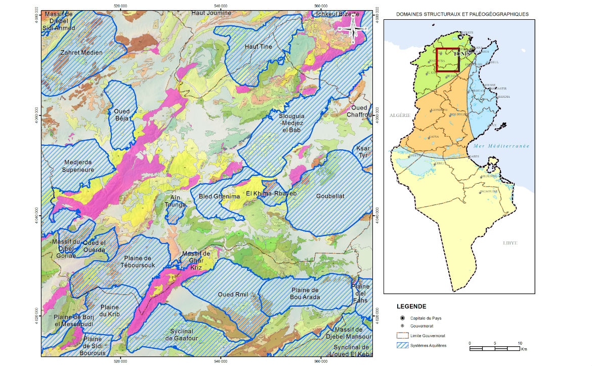
Moreover, it also includes a complete reordering of the hydrogeological management entities and a continuous geological mapping of the entire country at a scale of 1/200.000.
The tool will additionally have the capacity to integrate information generated by the National Information System on Water (SINEAU) as well as to exploit and assess databases of the Management System of Water Resources (SYGREAU). Furthermore, it allows drawing up thematic maps and eases reporting on temporary variables (piezometric levels, hydrometric, precipitations, temperature, evaporation, etc.) that specialists, decision-making organs and planners need.
